
After the last hike Photo Prataglia Badia, where the weather had not helped, I had been the desire to take some view from the ridge of the Tuscan-Romagna.
Friday, November 5, 2010 weather conditions were perfect: clear skies, wide visibility, thanks to the wind at high altitude. The perfect opportunity to test the path "Gea CT 00" long in the program. The trail runs along the ridge, crossing the Passo della Calla above Be.
I leave the car in the forecourt of the pass and head towards the side of the path that leads to Poggio Scali, vantage point at 1520 meters above sea level, at about 15:00. Maybe I started a bit late, now crossing a man who is already returning to his car. Yes, maybe it's a bit late. The trail runs almost completely along the ridge, and is overlooked by tall beeches. You do not see at all the views. And the path goes up too, right away.
After the first mile I see the first signs prohibiting access to the forest, both right and left of the path. On the right the Biogenetic "Bowl", left the notorious "reserve NaturaleIntegrale Sasso Fratino .
The only viable area of \u200b\u200bthe path, a corridor that runs between the two reserves inaccessible. Every time I look to the left and right, along the slopes: huge trees, of course, there is no soul.
few colors, there is a strong wind. The beech are bare, the leaves are already completely fallen, and these trees are all the same ... I see nothing but tall beeches, will almost boring, even had fog.
walk for over an hour, uphill, downhill, wind, and beech trees, I see nothing ... I do not have a map, the phone does not take ... I do not remember how far Poggio Scali. The trail is a bed of fallen leaves, below there are mud and stones, at times I lie down. Maybe I have walked 3-4 km, are the 16:20, there is no trace of Poggio Scali, likely to give up because the sun is already low, that rip-off ... it will be another time ...
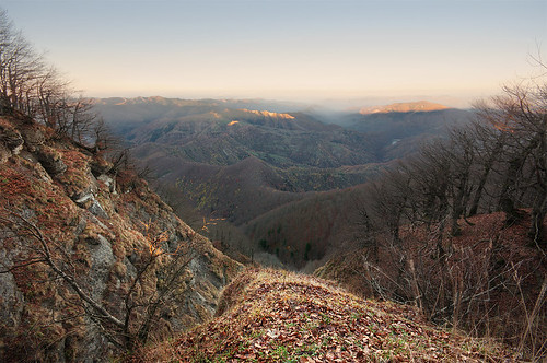
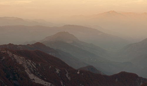
... then left the trail opens up a cliff, under I see a good portion of Fratino Sasso, after all, a branch of Lake Ridracoli, under huge trees, vertiginous slopes ... now I understand why it is a reserve, even if it is really impossible to venture down from the ridge.
now continues a little longer ... here, I see Poggio Scali. I expected a summit ... is the highest count, which goes on for a few meters from the path. I left the forest and climb up to the vantage point ... I was wrong, the light is still plentiful, just come out from the beech.
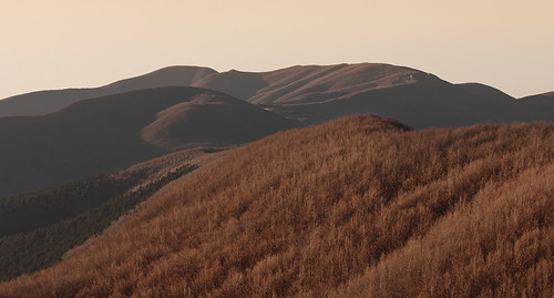
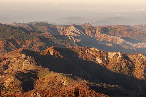
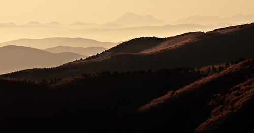
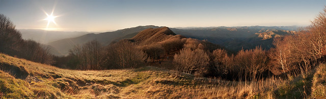
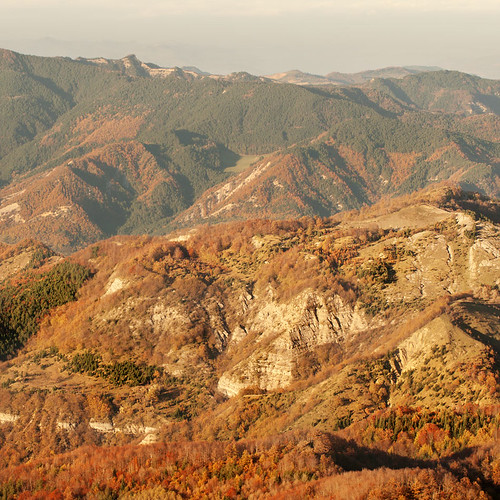
On top of Poggio Scali, the view is crazy. They told me that if you are lucky, from there you can see the Adriatic, I have no problem believing it. You see the whole ridge I walked, we see that distant ridges, one after another, gradually moving away in this little mist.
seems to be on a terrace surrounded by forests, a part of Tuscany, Emilia-Romagna the other.
some photos ....
then starts to get really late ...

back in the woods and go down there starts to be really dark.

Way back along the path to the Passo della Calla, I'm sweating because I'm running, it is cold and the wind pulls growing bastard, it's dark ... I think the wolves , spot wolves ... I got to the car at 18:15, I'm soaked, I'm lying, for indeed, because of a hole down and those 10 kg backpack that I brought along ... but it was really worth it? I have little doubt!